CN15 - Comillas - Unquera - 26,6 Km
Itinerary
From the pilgrims’ hostel, you will get to Saturnino Fdez. De Castro Street, La Aldea, and Marqués de Comillas Street. You will leave Sobrellano Palace on the left side and continue on the bicycle lane, parallel to the CA-131, leaving behind the last houses in Comillas to get to Rubárcena centre, where Comillas football pitch is located.
Keep going on until you get to La Rabia Bridge, which will lead you to Vadáliga (Saja – Nansa). On the right side, you will see Zapedo marshlands. Soon after you will arrive at an intersection to your left, ascending towards a fork where you will turn right, connecting with the CA-363 from Treceño to Tejo. Once you get to the secondary road, you will continue on its left side, passing by Santa María del Tejo Church, located behind the cemetery. From the left margin of the church, you will enjoy a splendid view.
From the church, you will continue on the CA-363, on the bicycle lane, to then enter Tejo via Santa Ana Borough. You will leave the road and follow the street leading towards the main square. Then, turn right on the local path between houses, heading to Cara.
Once you get to Cara Borough, you will leave the road near San Juan Chapel to then get to a byroad, continuing on the left. Soon after, you will find the first fork, where you will turn right and then another one, turning left.
After this, you will descend and turn left, to then cross a little stone bridge over Capitán Stream and enter San Vicente de la Barquera. Keep going on ascending surrounded by vegetation. On the left margin and bordering the characteristic forest, you will see the stream. The way will lead you to La Revilla, a village you will access via Iglesa Borough and where you will find San Pedro Church.
Leaving the church to the right, you will get to a roundabout and turn right to then get to an intersection of the regional road from Comillas to San Vicente. Cross the road CA-131 and keep going straight on, turning left after 10 m on a byroad to avoid entering La Revilla. 100 m ahead, you will get to another intersection, next to a house on the right side; here, you will turn left and go up on a path to Riboria mountains, where you will see another path coming from the left joins. Continue on the right and you will get to another fork where you will turn right again.
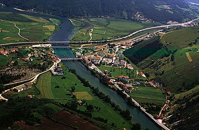
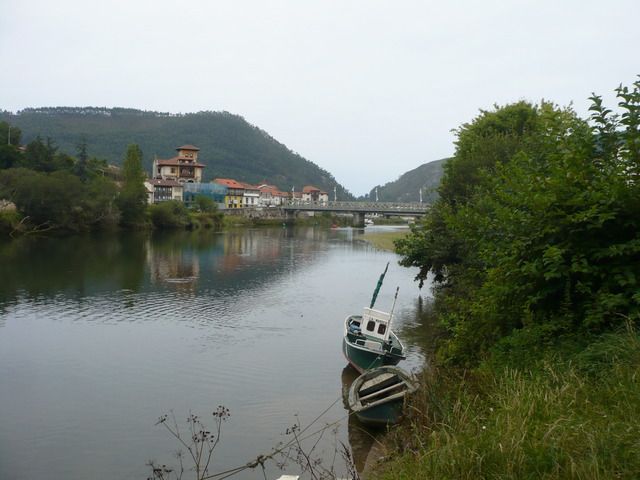
Once you get to the top, you can enjoy the great sights. Next, you will descend parallel to the N-634, getting to a local path and continuing on it, on the left side. At the end of the descent, you will get to the road leading towards the beach, but this time your way heads to the long Maza Bridge; cross it and you will enter San Vicente de la Barquera.
From the pilgrims’ hostel, you will go down the streets of José Mª Pereda and Roda de la Encrucijada, and then turn right on the street known as “Camino Alto de Santiago” or “Camino de las Calzadas”. After this, you will get to La Barquera residential area, turning left on the local road and passing by La Calzada Borough, heading on the opposite direction to Brazo Mayor river estuary (on the right side). This path leads directly to Acebosa. After passing between the hills of San Martín (to the right) and Cueto (to the left), you will enter the town crossing the bridges over the highway and the railroad. Continue straight on to then connect to the CA-843, next to San José Church.
You will leave from San José Church (in Acebosa) and go down the road CA-843 to then turn right after 100 m and take a byroad. This path leads to the cemetery. Continue on a path that starts a hard ascent and will take you to a hill where the cemetery is located; from here, you will keep walking on a paved road to get to an intersection, continuing straight on and descending to connect again with the CA-843. Once you get there, you will keep going on its left side for some metres, until you get to the fork with the sign indicating the way to Estrada and Pesués. Continue on the road for another 500 m, passing by Hortigal, place where the Way of St. James and Lebaniego Way separate. Keep going straight on, heading towards Estrada. Later on, after 2 km, you will ignore the local road of Serdio and continue straight on to the medieval tower in Estrada.
You will get to the first houses in the village and leave the road taking a path to the right, under the medieval tower. Continuing on the path, you will get to a fork where you will turn right and then you will reach the local road of Serdio (CA-844), following it to the left and entering the village via El Corraluco Borough. Then, you will pass by La Aldea Borough and arrive at the main square, where San Julián Church is located; turn right on the first entrance and you will get to the pilgrims’ hostel.
Leaving from the pilgrims’ hostel, you will go down to the church and continue to the right. Abandon the town centre and you will access to the paved road where you will find a fork, turning to the left. Later on, you will pass by a sand quarry and continuing straight on, you will get to the CA-181 towards Muñorrodero, a village that you will see on your left.
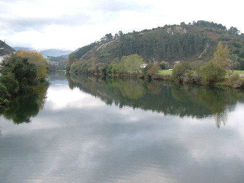
Continue on the right of the road, leaving the river on the left side, and later on you will pass a tunnel under the railroad, leading you to Tina Menor river; then, you will pass under the Cantabrian highway viaduct. Cross the bridge over the river and turn left on the street next to it (Valledal Street); this will lead you to Pesués town centre.
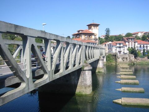
Immediately, you will enter a path to the left and cross over the highway, going up to Prío; at the beginning, you will turn right on an ascending path that later goes parallel to the railroad and heads towards Unquera town centre. Continue on a nice promenade to the town centre and then turn right on the intersection to the bridge.
External info sources about this route and recommended websites:
www.cantabriajubilar.com
If you want to download any route in PDF format, you need to be registered. This is a very easy and free of charge process, and you will also enjoy other advantages.
To download a route in PDF format you must be registered , this is a simple and free process also enjoy other benefits.